Recent geophysical surveys and satellite missions have unveiled a startling hidden world beneath Antarctica’s ice: enormous mountain ranges, sprawling lakes and rivers, hundreds of volcanoes, and relics of ancient ecosystems, all preserved under kilometres of ice. These discoveries, made possible by ice-penetrating radar, seismic imaging, and gravitational measurements, are reshaping our understanding of Earth’s coldest continent and its role in past and future climate change.
Subglacial Mountain Ranges
The Gamburtsev Mountains, comparable in scale to the European Alps, lie completely buried beneath over 4 km of East Antarctica’s ice sheet, first hinted at by Soviet seismic data in 1958 and now imaged in detail using radar and gravimetry. Scientists remain puzzled as to how such a high, rugged range formed and survived in the heart of a geologically stable craton.
Vast Lakes and Hidden Rivers
Antarctica hosts more than 400 subglacial lakes, the largest being Lake Vostok, located under 2.5 miles of ice, which may harbour unique microbial life adapted to extreme pressure and darkness. A recent Nature Geoscience study directly observed active subglacial streams in West Antarctica, revealing a network of meltwater channels that lubricate ice sheets and can trigger sudden outburst floods. ESA’s CryoSat mission further mapped how these hidden lakes drain unpredictably, exacerbating ice loss and sea-level rise.
Hidden Volcanoes and Geothermal Heat
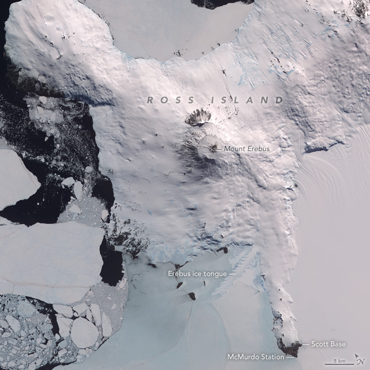
Over 100 volcanoes are estimated to lie dormant or active beneath the Antarctic ice, including known vents like Mount Erebus, with new research showing that ice melt can reduce pressure on magma chambers and potentially trigger eruptions. Modelling suggests that continued thinning of the ice sheet could unleash a cascade of subglacial eruptions, with profound implications for ice stability.
Ancient Landscapes and Fossils
Beneath the ice lie remnants of a warm, forested Antarctica: geologists have traced a 40-million-year-old river system nearly a thousand miles long in West Antarctica, pointing to fundamentally different past climates. In addition, fossil discoveries, such as the remarkably preserved skull of Vegavis iaai, reveal that early modern birds once roamed the continent, offering a window into evolutionary history. Vegavis iaai is an extinct waterfowl from the Late Cretaceous of Antarctica, representing one of the earliest known crown-group birds. Its nearly complete skull, unearthed from beneath over two miles of ice, confirms that duck- and goose-like birds were already diversifying around 69 million years ago.
Implications for Climate and Earth Sciences
These hidden features are not merely geological curiosities, they critically influence ice-sheet dynamics and future sea-level projections. As researchers continue to refine sub-ice models, understanding this concealed topography and hydrology is essential for predicting Antarctica’s response to warming and its global impacts.